2019
2018


2015
Carte du monde créée par des gens comme vous et libre d’utilisation sous licence libre.
OpenStreetMap (OSM) est un projet international fondé en 2004 dans le but de créer une carte libre du monde. Nous collectons des données dans le monde entier sur les routes, voies ferrées, les rivières, les forêts, les bâtiments et bien plus encore !
Dans la base on trouve de tout : route, rail, transports en commun, vélo, rando, hébergement, restauration,… Aucun objet n’a de priorité : les contributeurs viennent souvent avec un centre d’intérêt mais ne sont pas des cartographes : la carte sert à développer quelque chose, à militer (par exemple pour l’accessibilité publique). On a donc une vraie diversité des données et des usages variés : fonds de carte, calculs d’itinéraires, recherche d’adresses, analyses spatiales…
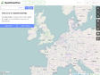
Le rendu cartographique peut prendre plusieurs formes : carte routière « classique », cartographie d’un quartier, carte des transports en commun, carte pour cyclistes et tout ceci pour un même quartier par exemple. On peut également appliquer des styles : aquarelle, pirate, …
OSM sert aussi de base à des cartes interactives, comme celle de l’accessibilité des passages piétons : on peut cliquer pour avoir plus d’informations et même des photographies. Des administrations comme la police te la gendarmerie l’utilisent.
Les données cartographiques collectées sont ré-utilisables sous licence libre ODbL (depuis le 12 septembre 2012).


2014
Leaflet - a JavaScript library for mobile-friendly maps
Leaflet is a modern open-source JavaScript library for mobile-friendly interactive maps. It is developed by Vladimir Agafonkin with a team of dedicated contributors. Weighing just about 33 KB of JS, it has all the features most developers ever need for online maps.
Leaflet is designed with simplicity, performance and usability in mind. It works efficiently across all major desktop and mobile platforms out of the box, taking advantage of HTML5 and CSS3 on modern browsers while still being accessible on older ones. It can be extended with a huge amount of plugins, has a beautiful, easy to use and well-documented API and a simple, readable source code that is a joy to contribute to.

Ce que Facebook peut dire de vous...
Facebook Report est un service de excellent Wolfram|Alpha. Il permet de visualiser simplement, via l'analyse de votre compte du même nom, votre profil. Cartographie des relations, mots clés utilisés, Age moyen et sexe de vos relations... tout y passe ! Il y a des gens à qui ça devrait faire peur...
Visualiser vos cercle d'amis grâce à vos échanges d'email
Immersion est un projet d'université qui vous permet de visualiser facilement, via l'analyse de vos emails (Gmail, MS Exchange ou Yahoo), vos cercles d'amis. C'est aussi un bonne façon de voir ce que connait ces grandes entreprises (et la NSA) de vous.
40 Maps That Explain The Middle East
Maps can be a powerful tool for understanding the world, particularly the Middle East, a place in many ways shaped by changing political borders and demographics. Here are 40 maps crucial for understanding the Middle East — its history, its present, and some of the most important stories in the region today.
2013
ParisData - Paris ouvre ses données publiques
Paris ouvre ses données publiques
Tout organisme d'une certaine taille collecte, génère ou maintient un important volume de données électroniques (bases de données, systèmes d'information cartographiques, registres électroniques, etc.).
Les données que possède la Ville de Paris sont exploitées au mieux par les services municipaux dans le cadre de leurs missions, mais constituent également un patrimoine immatériel qui peut être mis en valeur pour l'ensemble de la collectivité :
les chercheurs peuvent y trouver matière à nourrir leurs travaux et expériences,
les développeurs peuvent créer des services innovants utilisant ces données,
les citoyens et journalistes y trouvent des informations brutes,
les entreprises peuvent fournir une valeur ajoutée à ces données, et ainsi créer de l'emploi et de la richesse pour la collectivité.
Le mouvement « Open Data » (données ouvertes) vise à obtenir de tout type de structure, et notamment des collectivités publiques du monde entier, la mise à disposition de tous, de façon libre et gratuite, des données électroniques.
C'est dans cet esprit de transparence et d'innovation ouverte que le Maire de Paris, Bertrand Delanoë et son adjoint en charge de l'innovation, de la recherche et des universités, Jean-Louis Missika ont proposé au Conseil de Paris, en juin et décembre 2010, de délibérer sur l'ouverture des données publiques de la Ville de Paris.
L'ouverture de ce site, en janvier 2011, marque la fin d'un premier cycle d'exploration des données de la Ville, mais surtout le début d'une démarche : de nombreux jeux de données viendront s'ajouter à ce catalogue dans les mois qui viennent, au fur et à mesure des contributions des différents services municipaux.
Cette démarche d'ouverture des données publiques s'intègre dans une politique globale d'innovation ouverte menée par la Ville de Paris depuis 2008, dans laquelle la Ville toute entière devient un terrain d'expérimentation, et où les habitants deviennent co-concepteurs des évolutions de leur Ville.

Vector Tiles for MapBox Streets | MapBox
MapBox has developed an open source vector format to power the future of our web maps.
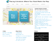
Placing Literature
Placing Literature is an online database of places from scenes in literature- sourced and plotted by readers and researchers.

Baidu Maps
Baidu Maps ou Beidu Maps est un service de cartographie en ligne chinois qui vise à concurrencer Google Maps en utilisant les futures images et relevés GPS du programme Beidou.
La cartographie de la Chine avait en 2011 un rendu visuel original, utilisant des dessins rappelant le jeu vidéo SimCity, à la place des images satellites classiques1

dis-moi où tu me plaîs
Carte interactive des amours métropolitains (sur la base des annonces de http://croisedanslemetro.com)

Development Seed
Development Seed is a creative data visualization and mapping team based in Washington, DC. We help organizations use data to explain complex issues and make better decisions. We work on projects with partners in government, international development, and the private sector who are trying to make things better, improve policy, and touch the lives of people around the world.
WhatWasThere - Put history in its place!
The WhatWasThere project was inspired by the realization that we could leverage technology and the connections it facilitates to provide a new human experience of time and space – a virtual time machine of sorts that allows users to navigate familiar streets as they appeared in the past.
